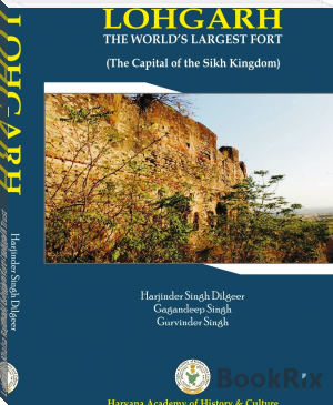
Lohgarh - Khalsa Rajdhani, Lohgarh fort - Lohgarh Trust by S. Daljeet Singh Bajwa (books that read to you .TXT) 📕
First time in the history of human race the Lohgarh Fort Sikh State Capital. If you wish to read Books on Sikh History in Punjabi and other language or wish to view Books on Lohgarh – World’s Largest Fort – and its history, you can visit to know more.
Read free book «Lohgarh - Khalsa Rajdhani, Lohgarh fort - Lohgarh Trust by S. Daljeet Singh Bajwa (books that read to you .TXT) 📕» - read online or download for free at americanlibrarybooks.com
- Author: S. Daljeet Singh Bajwa
Read book online «Lohgarh - Khalsa Rajdhani, Lohgarh fort - Lohgarh Trust by S. Daljeet Singh Bajwa (books that read to you .TXT) 📕». Author - S. Daljeet Singh Bajwa
skirmishes.3 Mughal warfare was inflexible when confronted with guerrilla tactics.4 In various incidents of this kind the Gurus had mustered troops from amongst their followers, the military exercises had been systematically encouraged, for building and towns in which a careful consideration was given to proper defenses.
In ancient times nature was used as a defense. Frequently the dense forest called as Vanh Durg and hills/mountains were called Parvh Durg. In the case of Lohgarh Fort and its battle field both the concept of Vanh Durg and Parvh Durg exist which was a great advantage to the Sikh forces. The geographical location of the Lohgarh Fort is such that, this place has dense forest on its North and South, the cumulative width of which is 14 km. the Lohgarh Fort was established as the Sikh State Capital, by Baba Banda Singh Bahadur in December 1709.The Sikh army not only had sufficient water but also had control over the water which flowed down to the enemy’s army. The Fort is designed in such a manner that it has a double Fortification system, i.e. one Fortification wall moves around the rivulet area and the other moves around the hill. The rivulets, passing through the Fort area, strategically bifurcated the Fort in such a fashion that each bifurcation system in exigency was in the protective support of the other area. Even if the enemy army succeeded in capturing any side, the whole Fort could not be captured at the same time as the Fort is divided along the rivulets and different protective defence belts. The Sikh army present in other parts of the Fort being at an advantage point could have easily reinforced and recaptured the lost portion. The bastions were established in such a fashion and position that each used to defend other. Watch towers/ chowkies were established strategically in such a manner that the view of the Som river is visible from every part of the Fort. Therefore, even when the Sikh army was outnumbered the enemy army failed to capture it because of its vantage point of defensibility. No cannons were effective on the strong impregnable walls of Lohgarh Fort. The flanks and rear of the Fort, were protected by narrow gorges and its face rested on nearly vertical slopes. The hill sides were overgrown with dense subtropical undergrowth, thick bramble, impenetrable mass of thorny shrub acacia,
cacti, lantana bushes, therefore a large scale assault was not possible, from this side. Therefore, Lohgarh Fort was chosen with excellent defensibility. In case of sieze there were many secret routes to escape out of the Fort. It is not possible to construct such a huge Fort in a short span of one or two years, and that too on a terrain which is about 1200 feet to 1900 feet above the sea level in the Shivalik hills. This land is still densely forested area and for a normal man it is not possible to even to make surveys of the area for making its design. The area is rich in minerals of limestone and metamorphic rocks are available in ample quality. Hence the raw materials must have been available on the spot for construction of the Fort. Lohgarh Fort was the capital having a model city with ample amount of water, food and ammunition.
The Western Side of the Fort
The elevated ridges (1200 to 1900 feet) of Dabar (lowest hills of Shivalik) were chosen as the battle field which extended from Udhamgarh (near Kala Amb) to Kalesar and exactly the centeral point of the ridges was chosen for the Fort Lohgarh. On the North side, i.e. near Udhamgarh, Markanda river flows which emerged from the Shivalik hills and flows to the plain area after passing about 20 km along the hilly boundaries of Dabar Hills, touching its feet. The width of the river while emerging into plain area is more than 100 meter, but as it goes into and towards Dabar hills, its width goes on decreasing and becomes deeper with more and more high brims on both sides of the hilly areas. As the part of the strategy the Mughal army laid a siege from 1710 to 1716, but it failed to achieve the stereotype objective. Now a days, along the side of Markanda river, a metalled road has been constructed from Nahan to Paonta Sahib, through these hills. A dense forest having thorny bushes, cacti, sub-tropical grasses, marshy meadows extends from the boundary of the river up to the Lohgarh Fort wall.
The area between the wall of the Fort and Markanda river was thus thickly covered with impassable forest and Sikh army made ramparts and trenches at weak points to plug the entry of the enemy. These thick thorny forests were also used as hide points of Sikh army so that
the enemy may be attached, suddenly in case of their entry from this side. It was impossible for the Mughals to make the estimate of arrangements made by the Sikhs in anticipation of a big war. There are many Khols (small rivulets) such as Haripur Khol, Lohgarh Khol which fall into Som River and make it a medium size river.
There is another river Boli Nadi, in the South side of the Fort, which touches the Dabar Hills foot beyond 10 km before it emerges in the plain area. This river is a seasonal one which flows heavily in rainy season, and brings sand down the hill in the river bed. This sand has gold particles and even today the district administration Yamuna Nagar, leases out the river beds for extracting gold. The Hill side of the river, having steep rise and some weak points was plugged with a heavy entrenchment up to the approach of Lohgarh Fort. There are other Khols such as Nagli Khol, which forms a big river called Pathrala, which makes a heavy discharge (30000 c.c. per second) of water during the rainy season.
The Southern Side of the Fort
The Southern side of Lohgarh Fort faces towards a plain; and, this area was used to produce food grains by the Sikhs. In between the plain area and the hilly area of Lohgarh Fort, Som river flows which finally makes its discharge in Yamuna river. It touches about 10 km from west with the feet of hills.
Khols and rivulets are passages which make approaches towards the Lohgarh Fort, which made the Fortification of the Lohgarh stronger because from the edge of Som river, hill slope were steep and had abrupt rise. This made the approach to Lohgarh Fort still tougher. Heavily ramparts entrenchments were constructed by the Sikh army to inflict heavy damage to enemy in case of attack from this side. A number of high pickets/Fortresses were raised, so that the enemy movement can be viewed from a distance.
The view of the Som river and its adjacent plain area are visible from high pickets/garhis. Many rivulets, ravines and many khols, emerging out from Dabar Hills, the flow of which falls in Som Nadi, ultimately emerge into Yamuna river. Light towers on the hillocks were
constructed, with objective to guide guerrilla Sikh fighters in the night time, so that after making raids on Mughals camp, they could safely retreat back to Fort. The cotton seeds were burnt in a small pond on the tower, this process generated light, which was highly luminous and could be seen from far distance. 52 bastions existed on the southern side of the Fort, starting from Indri, Ladwa, bank of Yamuna and spreads in district Yamuna Nagar. Most of the war between the Sikh and the Mughal armies was fought in plain area where 52 bastions of Fort Lohgarh existed.
The Eastern Side of the Fort
The Eastern side, which is the rear side of the Fort, is completely under a forest cover, which is now declared as the National Forest Park and now falls in the State of Himachal Pradesh. From Lohgarh Fort up to the towns of Paonta Sahib and Nahan, there is a thick wooded forest having bushes and sub-tropical grasses, where wild animals like bears, panthers, leopards, and tigers were often spotted in those days, and, hunters used to hunt them. At present all these wilds are kept protected in hedge made of thorny steel wires and tourists usually visit them through particular passages.
In those days, the approximate width of this forest was 8 km from the wall of the Fort. There were many secret passages to reach Lohgarh and were used for supplying essentials to the Sikh Army and in case of siege they acted as safe exit routes. From these passages Banda Singh, along with his troops, used to move towards Anandpur Sahib, Jammu and Chamba hills and also to the plain areas of Punjab for assault on Punjab cities. The Mughals were never aware of these routes. Moreover, these routes were properly entrenched with dressed stones so that the enemy could not take control of these passages. All the entry points from the front side to the rear side of the Fort were highly protected and Mughal siege was not possible from these directions of the Fort because of the Markanda and Som Nadi rivers and highly steep abrupt rise of hills from both sides. Only part of the front side, i.e. the southern side was exposed to the enemy attack.On this side of the Sikh army
made pucca trenches and obstacles in most of plain area. Sikh army kept Mughals engaged in war most of the time in plain area where 52 bastions existed before their attack on Lohgarh area. The siezure by the enemy on the front side, i.e. the southern side was not so effective, therefore, this lead to heavy damage to the Mughals during the war. The Lohgarh trustee explored deeply the area of the Lohgarh Fort with a good number of people because one could only enter it after cutting wild plants on the way. Lohgarh Fort, which is spread in 7000 acres, is divided further into sectors. So far 32 sectors of its area, which comprises about thousands of acres of land, have been surveyed. Each sector is situated on different hillocks. There are dual-protection walls enclosing each sector. The foundation of the ramparts could be seen especially at vulnerable points, which were properly plugged with stone walls. Each sector supported as a defense for the adjacent sector.
In case one sector was captured by the enemy, the other men sitting in the adjacent sectors could inflict heavy damage on them with their gunshots, as the area came directly under their range due to higher contours. Many areas of Lohgarh are still under exploration because it can be inspected only after cutting wild plants. The outer wall of the Lohgarh Fort is not found continuous. The foundations are clearly visible at vulnerable points. The foundation about 2.5 to 3 meters wide and it is not visible where the wall join steep rise of the hills. Fort’s outer circumference of the wall, including hill width is about 50 km. How could this huge Fort, which is further defended by the Fort wall around each sector, be conquered by the Mughal army in one throw and one day as narrated by some historians. As the strategy of war, the Mughal army used to lay siezure of the enemy posts, thus cutting their supplies of essential materials required for the


Comments (0)